Mass’ Battleye electronic warfare simulation software is intuitive and highly capable. Armada has put it through its paces over the last few months.
Armada has been privileged to have been given access to MASS’ Battleye mission support tool. We have used the software to simulate the performance of Russian Army Electronic Warfare (EW) assets deployed to Ukraine. Battleye can be fed with several factors influencing an EW system’s performance and the software can account for local terrain effects on radio propagation. For this article, your correspondent used it to demonstrate the hypothetical performance of a Communications Intelligence (COMINT) system.
Getting Started
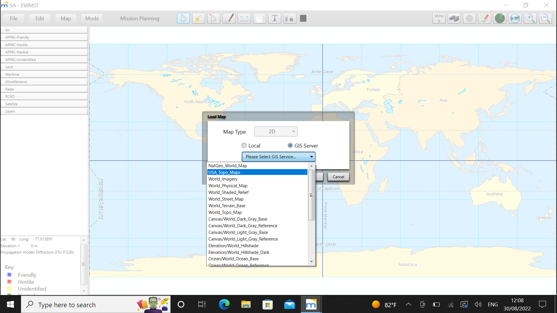
Battleye is nicely intuitive. The first thing to do after opening the programme is choose where your EW system will be deployed. This is easily done by selecting one of several maps available in the software thanks to an internal database and embedded Geographic Information System (GIS) server. For this hypothetical scenario, the GIS server’s ‘World Imagery’ map was used.

Worldwide Capabilities
Once you have decided where to deploy the EW system, you can place it on the map. This positioning can then be fine-tuned to a precise location as required. Our scenario had the COMINT system being deployed near Maidenhead, a town 43 kilometres (27 miles) west of London. The user then chooses the formation or asset deploying the system. This is easily done from a side menu with ‘friendly’, ‘hostile’, ‘neutral’ and ‘unidentified’ units. The COMINT system was deployed with a friendly electronic warfare squadron in our scenario.
A pop-up lets you determine the unit’s exact role with up to 14 different missions being nominated. These include electronic support, electronic attack and counter-improvised explosive device tasks. Our scenario saw the squadron given an electronic support role. The quality of the radio communications between the ESMs can now be calculated through the ‘Path Profile Analysis’ function and locations altered if necessary to provide a well-connected baseline of ESM assets.
Simulating Effectiveness
Once the mission is selected, a second pop-up menu appears on which parameters concerning the units’ equipment are entered. The user can add its call sign, in this case ‘COMINT Squadron 1’, along with its allegiance (friendly) and the environment where it has been deployed, in this case ‘rural’. If desired, the user can add details of the squadron’s ESM communications network. These include the types of radios it is using, their transmit power, antenna gain, minimum and maximum frequencies, and antenna height.
In terms of the squadron’s EW capabilities, it was equipped with a light Electronic Support Measure (ESM) with a sensitivity of -90dBm (decibels/milliwatts). An omnidirectional antenna for the ESM can be simulated, however we chose to give it a directional antenna. This had a southwest bearing of 225 degrees, fanning out 45 degrees either side. The ESM covered a Very/Ultra High Frequency (V/UHF) waveband of 30 megahertz/MHz to three gigahertz and had a three metre (nine feet) antenna. Once these capabilities were entered the unit was shown on the map, marked with appropriate symbology and identified by its call sign. It should be noted that all parameters can be altered by the user to get to real world values,

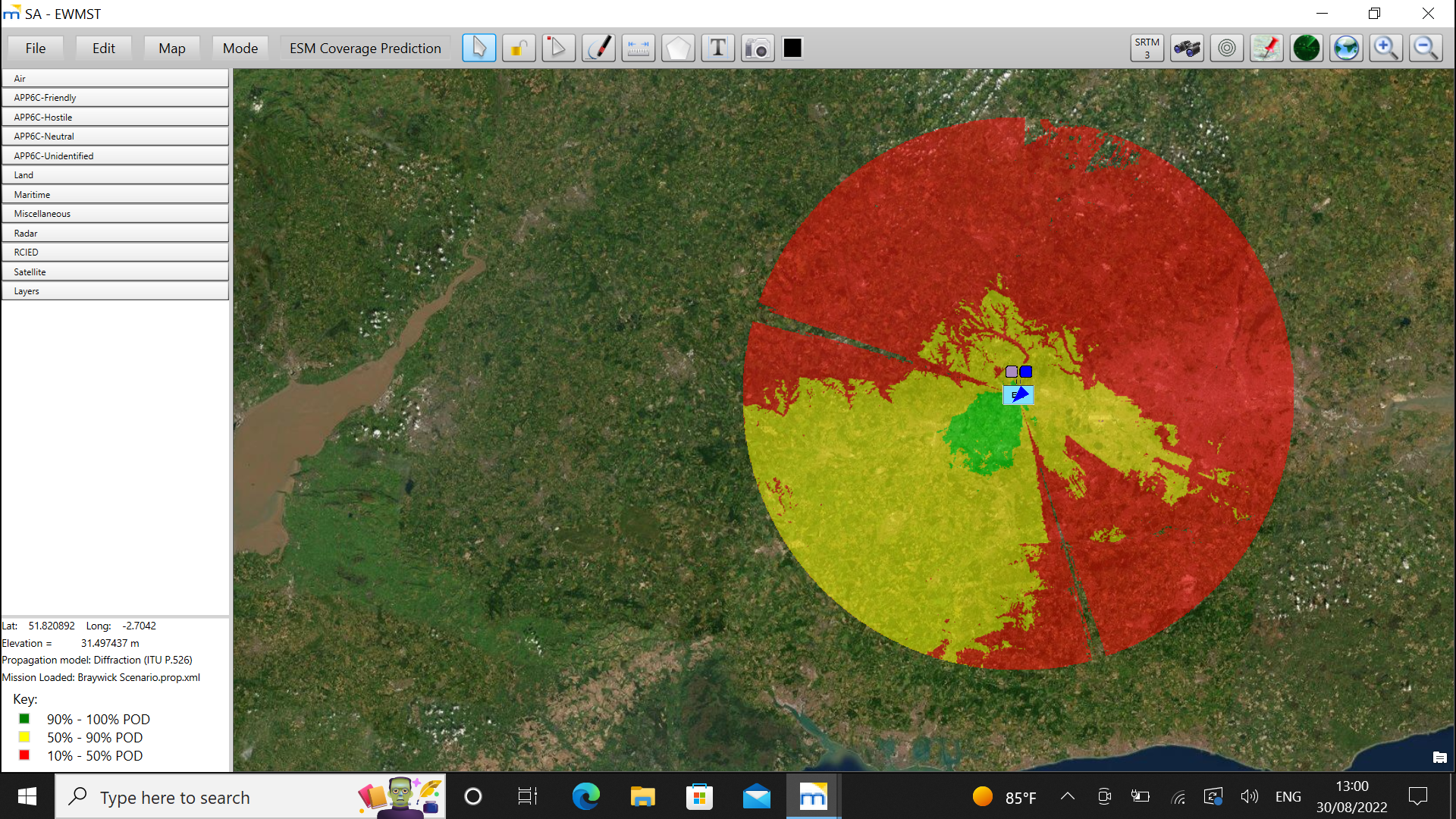
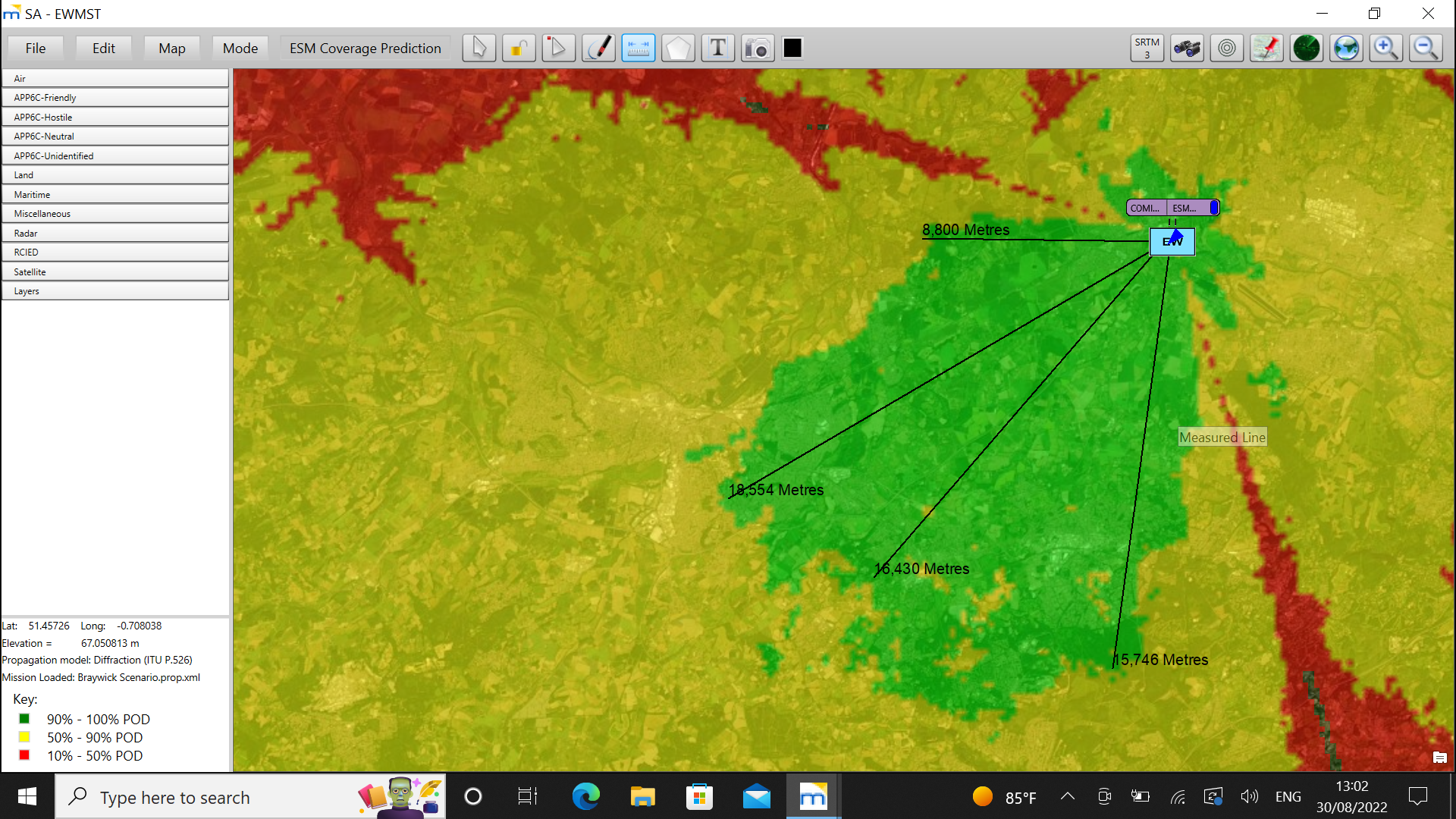
Now the fun began. The next step was to show the hypothetical coverage of our COMINT system. The user can select the ‘Mode’ menu and then ‘ESM Coverage Prediction’ from the ESM submenu. After a few moments, Battleye depicted the ESM’s potential coverage based on its parameters and local topography. The green area denotes a 90 to 100 percent Probability of Detection (POD) for V/UHF emitters. The yellow area denotes a 50 to 90 percent POD and the red area a POD of ten to 50 percent. As can be seen from the map below, coverage is by no means uniform. Local terrain is undulating meaning some places will be within the ESM’s line-of-sight and some will not. The ruler lets you measure the range of these areas of coverage or the range ring function can be utilised up to a distance of 60km (37.3 miles). As we can see, the ESM should be able to detect V/UHF emitters at ranges of up to 19.5km (12.1 miles).


Assessment
Battleye has some minor shortcomings. The software can take may take some time to load its maps, although this could be a result of using WiFi to access the GIS server. This can be overcome by storing maps locally if WiFi is not available. Moreover, a simple ‘undo’ function would be a nice addition. Sometimes your correspondent made mistakes when entering information on the map. Clearing drawings and unwanted data from a map using the ‘Edit’ function can be a tad laborious.
That notwithstanding, Battleye is an excellent tool. This article has barely scratched the surface of what it can do. The software is relatively easy to use and a couple of hours with one of MASS’ friendly, and very patient, instructors enable one to become proficient enough. Like anything, it is then a matter of playing with the software and getting comfortable with it, allowing you to explore its full potential. Usefully Battleye can also simulate the integrity of communications links between radios. This is something that will be explored in a future article on the Armada website.
by Dr. Thomas Withington


